Bing Maps Walking Directions
Bing Maps Walking Directions provides detailed pedestrian navigation for travelers, tourists, and everyday walkers who prefer to explore on foot. Whether you are walking through a busy downtown district, navigating a college campus, or hiking a scenic urban trail, Bing Maps generates step-by-step walking routes that guide you safely and efficiently to your destination.
Walking is one of the most sustainable and healthy forms of transportation, and having accurate walking directions makes it easier to choose walking over driving for shorter trips. Bing Maps calculates pedestrian-specific routes that follow sidewalks, pedestrian crossings, footpaths, and public walkways — avoiding highways and roads restricted to vehicles.
How to Get Walking Directions on Bing Maps
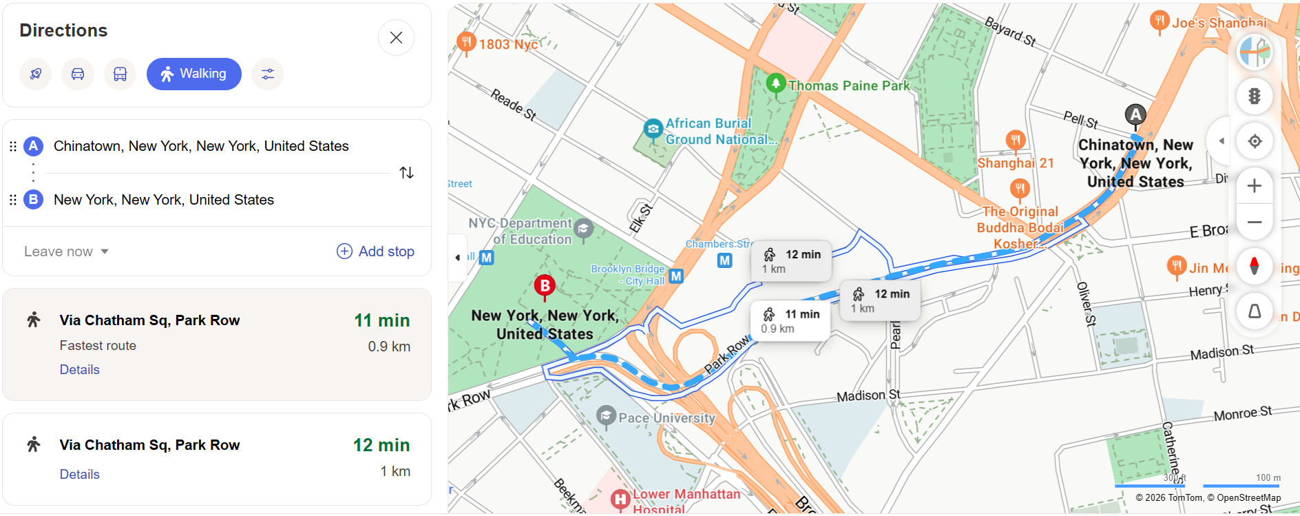
Getting walking directions on Bing Maps follows the same intuitive process as driving directions. Open Bing Maps, click the directions icon, and enter your starting point and destination. Instead of selecting the car icon, click the walking figure icon to switch to pedestrian mode. Bing Maps will calculate the optimal walking route and display it on the map.
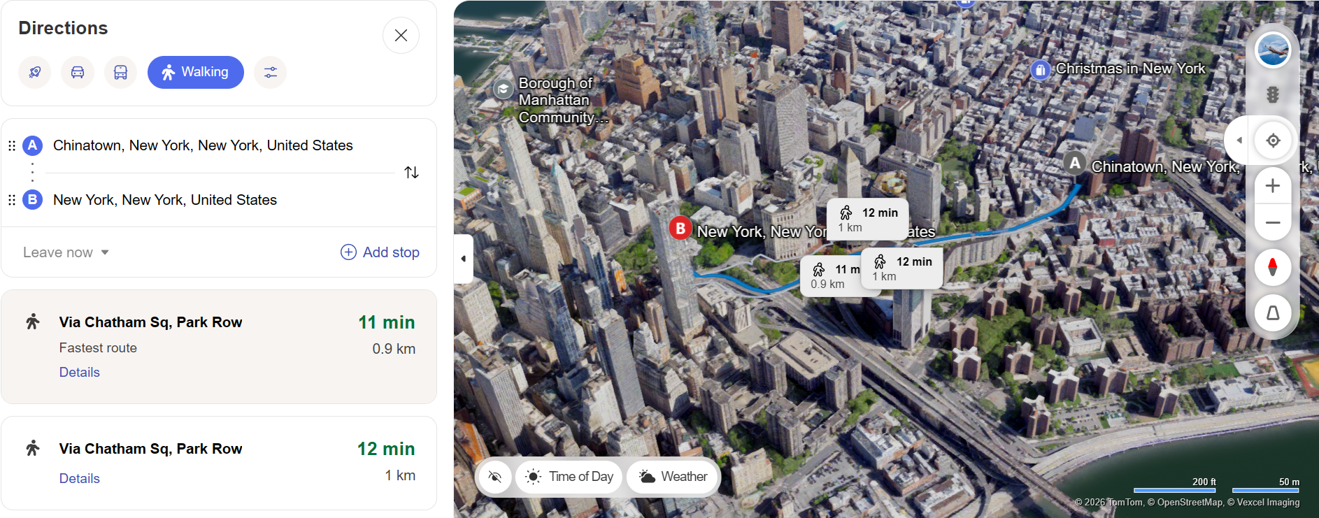
The walking route includes the total distance in miles or kilometers, the estimated walking time based on an average walking speed of approximately three miles per hour, and turn-by-turn instructions for every street crossing, path change, and directional shift along the way.
Features of Bing Maps Walking Directions
Pedestrian-Optimized Routes
Unlike driving routes that prioritize highways and major roads, walking directions focus on pedestrian infrastructure. Bing Maps identifies sidewalks, crosswalks, pedestrian bridges, park paths, and public squares to create routes that are safe and comfortable for walkers. The system avoids highways, tunnels, and roads without pedestrian access.
Accurate Walking Time Estimates
Bing Maps calculates walking times based on standard pedestrian speeds, typically around 3 to 3.5 miles per hour. The estimates account for the route's distance and general terrain. While individual walking speeds vary, the estimates provide a reliable baseline for planning your schedule and arrival time.
Visual Route Mapping
The walking route is displayed on a detailed map with clear markers for every turn and landmark along the way. You can zoom in to see individual streets and intersections, helping you familiarize yourself with the route before you start walking. The Street View feature allows you to preview key turns and intersections at street level.
Integration with Transit
Walking directions often complement Transit Directions routes. If your journey involves taking a bus or train, Bing Maps can provide walking directions to and from transit stops, creating a seamless multi-modal travel experience. This integration is particularly valuable in urban areas where combining walking and transit is the most efficient way to travel.
When to Use Walking Directions
Exploring a New City — When visiting an unfamiliar city, walking directions help you navigate between attractions, restaurants, and hotels without getting lost. Walking allows you to experience the local atmosphere and discover hidden gems that you might miss while driving.
Short Urban Trips — For distances under two miles in urban areas, walking is often faster than driving when you factor in traffic, parking, and walking from a parking spot to your final destination. Bing Maps walking directions help you find the most direct pedestrian route.
Health and Fitness — Many people use walking directions to plan exercise routes. Knowing the exact distance and estimated walking time helps you set fitness goals, track your progress, and vary your walking routes for a more engaging workout experience.
Campus and Park Navigation — Large university campuses, industrial complexes, and public parks often have complex internal pedestrian networks. Bing Maps walking directions help you navigate these environments efficiently, saving time and reducing the frustration of wandering through unfamiliar grounds.
Tips for Better Walking Navigation
Preview Your Route — Before heading out, take a moment to review the entire walking route on Bing Maps. Identify key landmarks, major intersections, and any areas where the route changes direction. This mental preparation makes the actual walk much smoother.
Check Weather Conditions — Weather can significantly impact a walking trip. Rain, snow, and extreme heat all affect comfort and safety. Check the forecast before planning a walking route and adjust your departure time or choose an alternative transportation method if conditions are unfavorable.
Use Streetside View — Bing Maps Streetside imagery lets you virtually walk through key sections of your route before you leave. This is especially helpful for identifying tricky intersections, building entrances, and pedestrian access points that might not be obvious from the top-down map view.